Places to Visit

Zagha Pilgrimage Site

Zagha Pilgrimage Site

Zagha, or the hermitage of St. Gregory the Illuminator, is located in the northern part of Sarnaghbyur village in Shirak Province, carved into the rock. The official name of the sanctuary is Andzavajur, but among the people it is better known as Zagha. According to local tradition, St. Gregory the Illuminator spent some time here in ascetic retreat or took shelter in this place. For this reason, the cave sanctuary became a pilgrimage site where people visit for prayer, vows, and spiritual peace. Inside the pilgrimage site, there is a prayer hall, a water basin, and a separate section connected with the sanctuary. The water is considered healing among locals and pilgrims, while icons, khachkars, spiritual books, and other offerings brought over the years are preserved inside the sanctuary.

Mher Mkrtchyan’s Portrait in Gyumri

Mher Mkrtchyan’s Portrait in Gyumri

This beautiful corner is located in the historic and cultural center of Gyumri, in the courtyard of KumKuma. Here, the old spirit of Gyumri blends with art and humor, creating a unique and memorable atmosphere. If you visit Gyumri, don’t forget to stop by this interesting mural and capture your beautiful moments here.

Lmbatavank

Lmbatavank

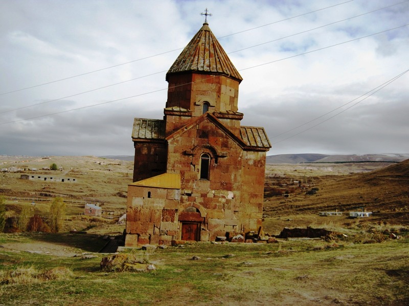
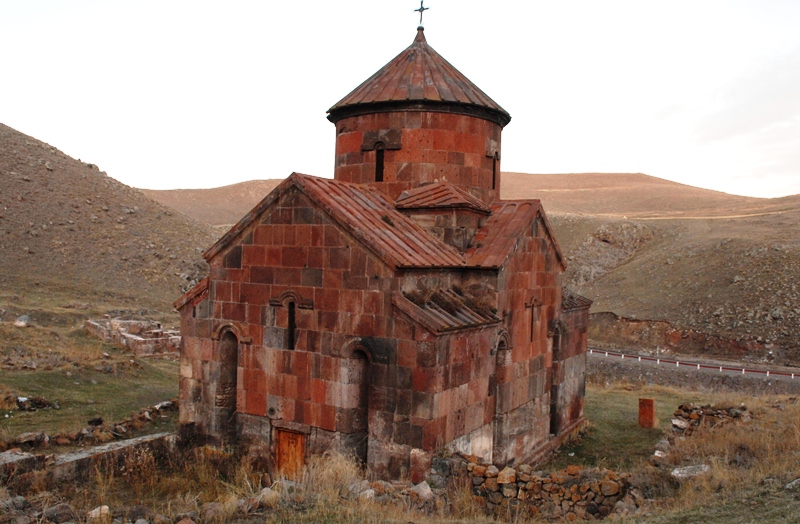
Lmbatavank is located in Shirak Province, about 1.5-2 kilometers southwest of the town of Artik, on the slope of a hill. It is also known as St. Stephen Church of Lmbatavank or St. Stephen of Sarnaghbyur. 
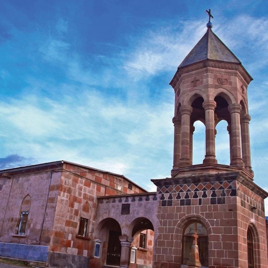
The church dates back to the 6th-7th centuries and is considered one of the most elegant early medieval monuments of Shirak. It is a cross-shaped, central-domed structure built of finely cut Artik tuff stone. Although Lmbatavank is small in size, it is architecturally expressive, with upward-looking proportions, a horseshoe-shaped apse, narrow arched windows, and an octagonal drum. Historical sources provide very little information about Lmbatavank, but the inscriptions preserved on the walls offer important details about the later life of the monastery. One of the earliest inscriptions dates to 1191 and is connected with Barsegh, the son of Vahram Pahlavuni. The inscriptions also mention villages donated to the monastery, such as Tsitsk, Sarnaghbyur, Hayrenyats Taghk, and Yardik, the area of present-day Artik. One of the most valuable features of the church is the remains of frescoes preserved inside. They are considered distinctive examples of Armenian monumental painting. The images preserved on the conch of the main apse and the eastern wall are connected with the scene of the “Theophany,” inspired by the vision of the Prophet Ezekiel. The surroundings of Lmbatavank were excavated in 1953-1954. During the excavations, bases of khachkars, graves from the 9th-10th centuries, carved fragments from the 7th-13th centuries, roof tiles, metal tools, and other findings were discovered. In the 1950s, the partially damaged dome, the coverings of the cross-arms, and the cornices of the church were also restored. 
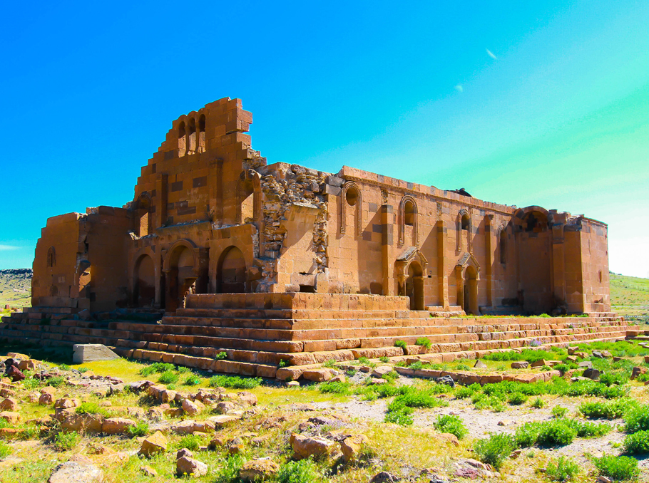
Today, Lmbatavank stands out with its modest size, dark tuff color, and views opening from the hill. It is an interesting stop for those who want to discover not only the well-known large monasteries of Shirak, but also quiet, ancient church monuments with deep historical value.

Hogevank Church

Hogevank Church

Hogevank St. Karapet Church is located in Shirak Province, about 3 kilometers northwest of the village of Sarnaghbyur, on the left side of the road leading to Maralik. This medieval complex is also known as the Red Monastery and Dzoragyugh Monastery. According to the inscription preserved above the northern entrance, the church was built in 1205. It belongs to the domed hall type of Armenian churches. On the eastern side of the structure is the semicircular main apse, with rectangular vaulted sacristies on both sides. St. Karapet Church has two entrances: one from the west and one from the north. Niches typical of Armenian architecture are preserved on the façades. The church was built of finely cut red tuff stone, which is why the complex became known as the Red Monastery. During later renovations, black and gray tuff stones were also used. The dome of the church collapsed during the 1939 earthquake and was restored in the 1980s. Inside the church, carved and inscribed fragments of 4th-5th-century quadrilateral monuments and 13th-century khachkars have been preserved. Some of them have been weathered over time and are now difficult to read. The area of Hogevank is important not only because of the 13th-century church. About 50 meters north of St. Karapet Church, the lower rows of the walls of a 5th-century single-nave church and a 7th-century tetraconch church have also been preserved. This shows that the site had Christian religious significance as early as the Early Middle Ages.

KumKuma Photo Zone

KumKuma Photo Zone

The KumKuma photo zone is located in the courtyard of KumKuma Restaurant, in the historical and cultural center of Gyumri. The image is taken from a scene of the well-known Armenian film “The Tango of Our Childhood,” which is closely connected with Gyumri’s atmosphere, local character, and memorable figures. The photo zone was created as a small photo spot for visitors. It is especially interesting for those who appreciate Armenian cinema and want to take a photo in Gyumri connected with the city’s cultural memory.

Trchkan Waterfall

Trchkan Waterfall

Trchkan Waterfall is one of the most beautiful natural sites in Armenia. It is located on the border of Shirak and Lori Provinces, on the Chichkan River, a left tributary of the Pambak River. The waterfall is also known as Chichkan Waterfall, Trchkan Jur, and by the local name Chran. The Chichkan River begins on the northeastern slopes of the Shirak Mountain Range, at an elevation of about 2,250 meters. The river is about 29 kilometers long, and its drainage basin covers around 192 square kilometers. In its upper course, the river flows through a relatively open valley, while in its middle course it enters a narrow and deep gorge, where it forms Trchkan Waterfall. The waterfall is 23.5 meters high. It is considered one of the highest and most powerful plunge waterfalls in Armenia. The water flow is especially impressive in spring, when the Chichkan River is fed by melting snow and becomes fuller between March and June. The origin of the name Trchkan is connected with the brown trout. According to a widespread legend, during the spawning season, the trout swam against the current and tried to “jump” over the waterfall. This image is believed to have given the waterfall its name, Trchkan. Since 2008, Trchkan Waterfall has been included in the list of natural monuments of Armenia. Today, Trchkan is a popular destination for nature lovers, hikers, and photographers. The waterfall can be reached on foot or by off-road vehicles, but the hiking route offers a fuller experience of the beauty of the Chichkan River gorge and the power of the waterfall.

Yereruyk Basilica

Yereruyk Basilica

Yereruyk Basilica is one of the most remarkable early Christian monuments in Shirak Province. It is located near the village of Anipemza, on the left bank of the Akhuryan River, not far from the historic capital of Ani. The basilica dates back to the 4th-5th centuries and is considered one of the unique examples of Armenian church architecture. Yereruyk is a three-nave basilica built of light orange tuff. It stands out for its large scale, exterior arched galleries, and composition placed on a multi-stepped platform. The structure was surrounded by steps leading to the basilica’s halls and entrances. The basilica had three entrances: two from the south and one from the west. There are different versions about the origin of the name Yereruyk. The most common explanation connects it with the Armenian word “yereral,” meaning “to tremble” or “to shake.” According to popular etymology, from a distance the basilica standing on its columns seemed to be trembling. This vivid explanation adds a sense of mystery to Yereruyk and makes it one of the most fascinating historical sites in Shirak. Yereruyk is important not only for its architecture but also for the archaeological environment around it. Traces of underground structures, a fortified area, a settlement, a reservoir, and a burial ground have been found in and around the basilica site. During excavations in 2011, an exceptional burial ground for early Christian Armenia was uncovered, containing numerous child burials. Many questions about the history of the basilica still remain unanswered. Historical sources contain almost no references to Yereruyk, and the surviving inscriptions are few. One of them mentions a donation made by the wife of Hovhannes-Smbat, one of the Bagratid kings, for the restoration of the basilica. Today, Yereruyk Basilica has survived in a semi-ruined state. Yet with its scale, silence, and open field setting, it continues to leave a powerful impression. In 1995, Yereruyk Basilica and its archaeological site were included in the UNESCO World Heritage Tentative List as an important monument of Armenia’s early Christian heritage.

Jrapi Caravanserai

Jrapi Caravanserai

Jrapi Caravanserai is located in the area of Jrapi village in Shirak Province. It is one of the important monuments of medieval Armenian secular architecture and is connected with the historic roads that linked the northern provinces and Georgia with Ani. The caravanserai dates back to the 10th-11th centuries. It belongs to the type of single-hall, three-nave vaulted structures. The building was mainly constructed of finely cut tuff stone and lime mortar, while the floor was paved with stone slabs. The preserved section is a three-nave hall, about 31 meters long and 13.65 meters wide. The hall was divided into three naves by two rows of pillars connected to each other by arches. Jrapi Caravanserai was built on the main route leading from Georgia and the northern provinces of Armenia to Ani. In the Middle Ages, such structures played an important role for travelers, merchants, and caravans. They were not only places for rest, but also key points in the organization of road life. Near the caravanserai, the Chirpli Bridge is also mentioned — a notable medieval structure built in the Akhuryan Gorge. It served the old trade route and was considered one of the largest bridges built over the Akhuryan River. The bridge also functioned as an aqueduct, transferring water from one bank to the other. Today, Jrapi Caravanserai has survived in a semi-ruined state. Even so, it still offers a glimpse into Shirak’s medieval road network, its links with Ani, and the significance of secular architecture in the region.

Lake Arpi National Park

Lake Arpi National Park

Lake Arpi National Park is one of the most unique natural areas in Shirak Province. It is located on the Ashotsk Plateau, at an elevation of more than 2,000 meters above sea level, in the northwestern part of Armenia, near the borders with Turkey and Georgia. Originally, Lake Arpi was a small natural lake, fed by nearby mountain springs, streams, and melting snow. Between 1946 and 1951, the lake was artificially expanded and transformed into a reservoir. Its surface area reached about 22 square kilometers, while its water volume increased to up to 100 million cubic meters. After this change, Lake Arpi became one of the largest bodies of water in Armenia, second only to Lake Sevan. The Akhuryan River originates from Lake Arpi, and the lake’s waters are used for irrigation and energy production. However, the value of this area is not limited to its water resources. The Lake Arpi basin and the Javakheti-Shirak Highlands are known for their rich biodiversity, wetlands, and habitats of rare bird species. To protect this natural environment, Lake Arpi National Park was established in 2009. The park is an important destination for birdwatching, nature exploration, and ecotourism. More than 140 bird species have been recorded here, and the world’s largest colony of Armenian gulls is located near Lake Arpi. The area is also the only nesting site of the Dalmatian pelican in Armenia.

Avetisyan’s Luxury Goods

Avetisyan’s Luxury Goods

Avetisyans Souvenirs is one of the small local shops in Gyumri where the city’s everyday creativity and craftsmanship become visible. It offers a selection of items connected to Armenian culture and local identity, reflecting both tradition and contemporary design. The shop presents a mix of souvenirs, ranging from pieces inspired by traditional motifs to more modern interpretations that combine national elements with current styles. Places like this are often shaped not by large-scale commercial logic, but by a more personal approach linked to local production and small businesses. Avetisyans Souvenirs can be seen as one of those points in Gyumri where the city is expressed not through landmarks, but through objects that people take with them as memories.

Faeton Ride in Gyumri

Faeton Ride in Gyumri

Gyumri’s faetons are among the oldest and most colorful symbols of the city. Before cars became widespread, these horse-drawn carriages served as the main means of transportation — a kind of city “taxi.” At that time, riding a faeton was more than just getting from one place to another. It was also a sign of status. Moving around with a well-kept carriage and a beautiful horse was associated with comfort and, in many cases, wealth. As cars gradually appeared in the city, faetons slowly disappeared from everyday life, but they never vanished completely. In Gyumri, there are still people who have preserved this tradition, maintaining both the carriages and the skills needed to build and drive them. Today, faetons have found a new role. They have become one of the city’s recognizable features. In the center of Gyumri, you can often see restored, colorful faetons offering rides through the old streets, showing the city from a different perspective — slower and filled with the spirit of the past. A faeton ride in Gyumri feels like stepping back in time — a chance to experience the city’s old rhythm, see its streets in a new way, and for a moment forget the pace of modern life.

Creaky Bookstore Gyumri

Creaky Bookstore Gyumri

The “Creaky” Bookstore in Gyumri is a unique cultural spot known not only for its books, but also for its distinctive atmosphere and concept. Located in the city center on Rizhkov Avenue, it operates under the initiative of the Shirak Diocese as a center for promoting spiritual literature and reading. The bookstore got its name from the sound of its old wooden floor, which produces a characteristic creaking noise when walked on. This feature gives the place its charm and makes it memorable for both locals and visitors. The bookstore mainly offers spiritual and religious literature, but it has long gone beyond being just a place to buy books. It has become a quiet space for reflection and inner calm, where visitors come not only to read, but also to experience its peaceful atmosphere. Today, the “Creaky” Bookstore is considered one of Gyumri’s most unusual and interesting attractions, reflecting the city’s cultural diversity and spiritual side.